Summary: Latitude vs X
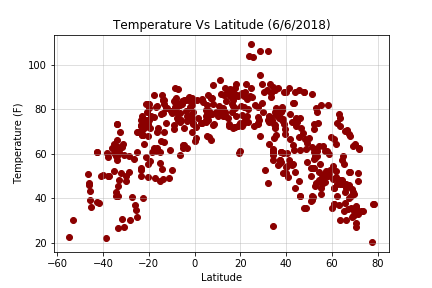
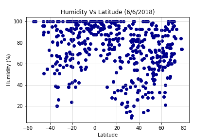
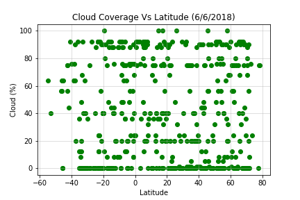
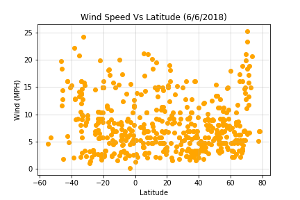
 This project was focused on working with API calls. My goal was to get various information about a city’s
weather (temperature, humidity, cloud coverage, and wind speed) and see how they relate to its latitude.
Constraints included making sure each city was unique and that it existed in all APIs I planned to use.
To generate the data, I first created a random set of 500 unique latitudes and longitudes. I then used the
python library citipy to get the coordinate’s closest corresponding city. It was at this point I realized
there might be a problem: what happens if the random coordinate point was in the ocean, and therefore the
nearest city was hundreds of miles away? To account for this, I fed the city name into Google’s API to retrieve
its true coordinates. Once I had generated 500 unique cities and coordinates, I used the library openweathermappy
to retrieve weather data from Openweathermap.org. Matplotlib was used to display the results.


